

New Zealand South Island Road Trip: Queenstown, Milford Sound, Mt Cook & the Glaciers in 10 Days
The classic South Island loop.
Ten days by car link the highlights of the mainland: Christchurch and the Canterbury Plains, the turquoise Mackenzie lakes and Aoraki/Mount Cook, adventure-capital Queenstown, the fiord at Milford Sound, the West Coast glaciers at Franz Josef, the lakes and ridgelines of Wanaka, and the whales of Kaikoura on the way home.
Best time: the long, settled days of December to March suit driving and hiking; winter from June–August brings snow to the passes and shorter daylight.
- Fly into and out of Christchurch (CHC); pick up a rental car and drive the loop clockwise via Tekapo, Mount Cook, Queenstown, Milford, the West Coast glaciers, Wanaka and Kaikoura.
- Distances are long and roads are often two-lane with one-lane bridges, so plan generous drive times and fuel up before remote stretches.
- South Island roads are mostly two-lane with one-lane bridges and winding alpine passes such as the Crown Range and Haast.
- Drive on the left, keep to the speed that suits the road rather than the sign, and allow far more time than the distance suggests.
Where to Stay
Use overnight bases that follow the clockwise loop
Where to Stay
Use overnight bases that follow the clockwise loop
Christchurch
Choose a central base for the first night and again on the return leg, breaking the long drive back from Wanaka before the final coastal run to Kaikoura.
Lake Tekapo
Stay two nights by the Mackenzie lakes, using the second day for the Aoraki/Mount Cook day trip about an hour each way.
Queenstown
Use Queenstown for two nights and as the base for the Milford Sound day trip.
Franz Josef
Stay a night by the West Coast glaciers.
Wanaka
Choose a quieter lakeside night close to Roys Peak.
Kaikoura
Visit on the final day from the Christchurch base, about two and a half hours up the coast, or add a seaside night here if you would rather not backtrack.
Official links & tickets
Confirm road, weather, track and visitor information with the official sources
Official links & tickets
Confirm road, weather, track and visitor information with the official sources
New Zealand trip planning
Use the national travel, transport, conservation, weather and regional visitor sites for current conditions.
Budget Snapshot
Getting Around
10-Day Itinerary Breakdown
Day 1: Arrive in Christchurch & the Botanic Gardens
Christchurch Airport (CHC) → city centre — arrival, rental-car collection and an easy riverside walk

Arrive in Christchurch and settle in
Land at Christchurch (CHC), the South Island's gateway; pick up the rental car or collect it in the morning, and take the first afternoon easy to adjust to the time change.
The Christchurch Botanic Gardens & the Avon
Take a gentle first-day stroll through the free public gardens along the Avon River in the city centre. Punting and the tram nearby are optional paid add-ons, but the gardens themselves are free.
Day 2: Drive to Lake Tekapo & the Mackenzie night sky
Christchurch → Lake Tekapo — the first driving day, a lakeshore stop and guided stargazing

The Church of the Good Shepherd on Lake Tekapo
View the tiny historic stone church on the lakeshore, with the turquoise lake and lupins around it. This is a free photo stop rather than a paid activity.
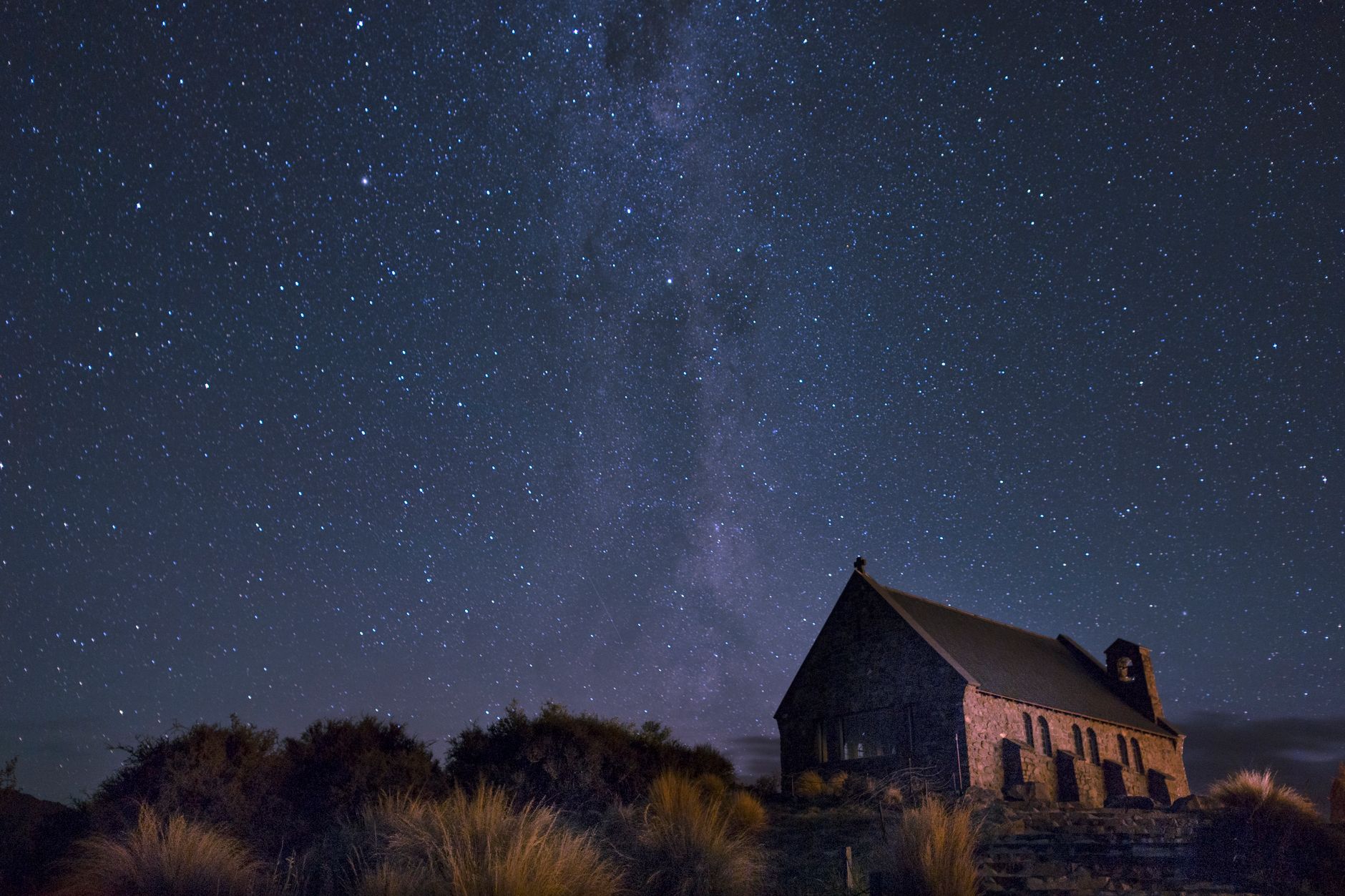
A Mackenzie Dark Sky stargazing tour
Join a guided evening stargazing or observatory tour on Mt John inside the Aoraki Mackenzie International Dark Sky Reserve.
Settle into Lake Tekapo
Base for the night by the lake; if the weather is clear, the stars need no introduction.
Day 3: Aoraki/Mount Cook day trip from Lake Tekapo
Lake Tekapo → Aoraki/Mount Cook → Lake Tekapo — a day trip of about an hour each way for a valley walk and a guided glacier-lake boat trip, back at Tekapo for a second lakeside night
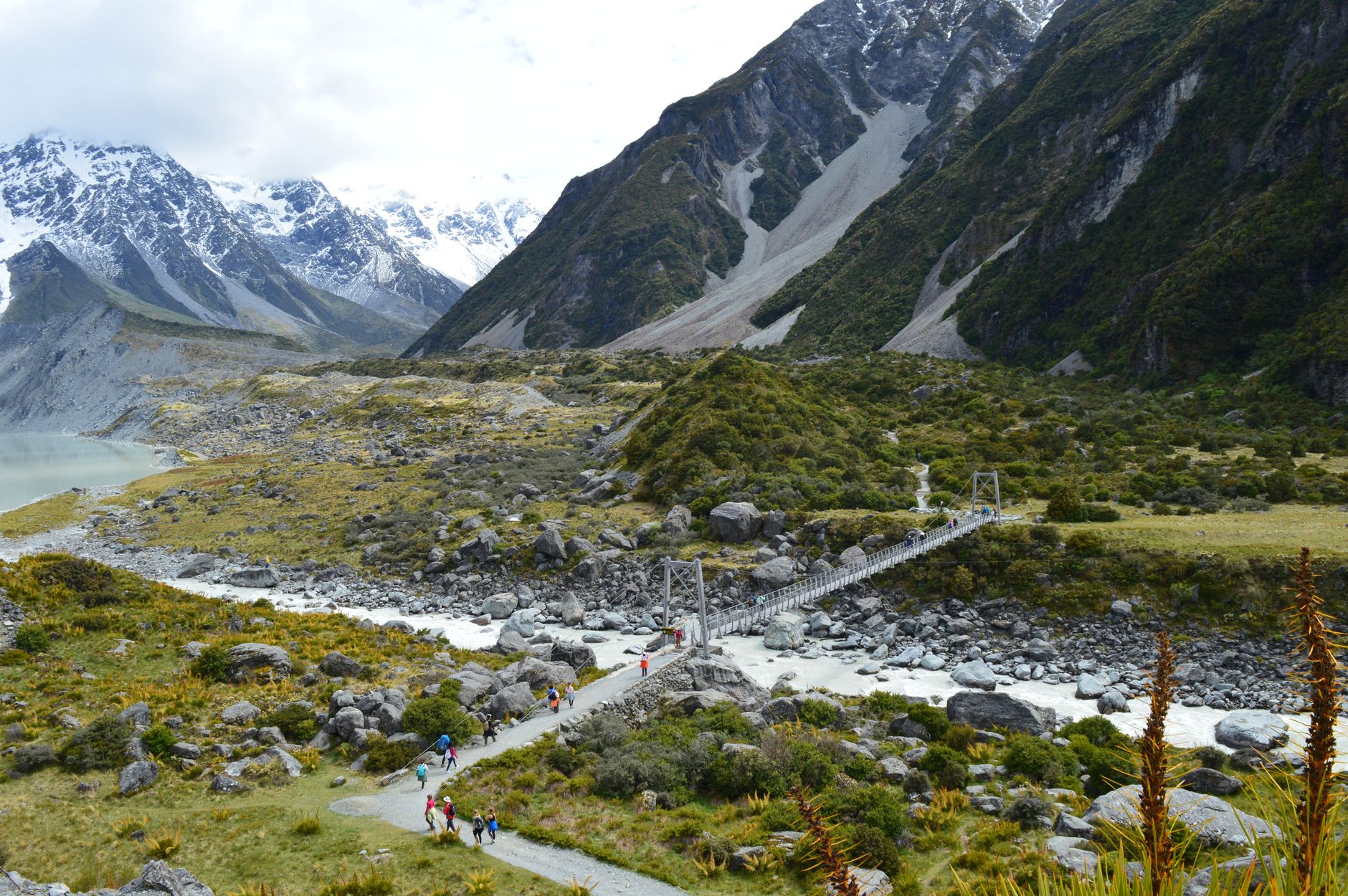
The Hooker Valley Track
Walk the free, mostly flat public track over swing bridges to a glacial lake below Aoraki/Mount Cook. Bring layers and water.
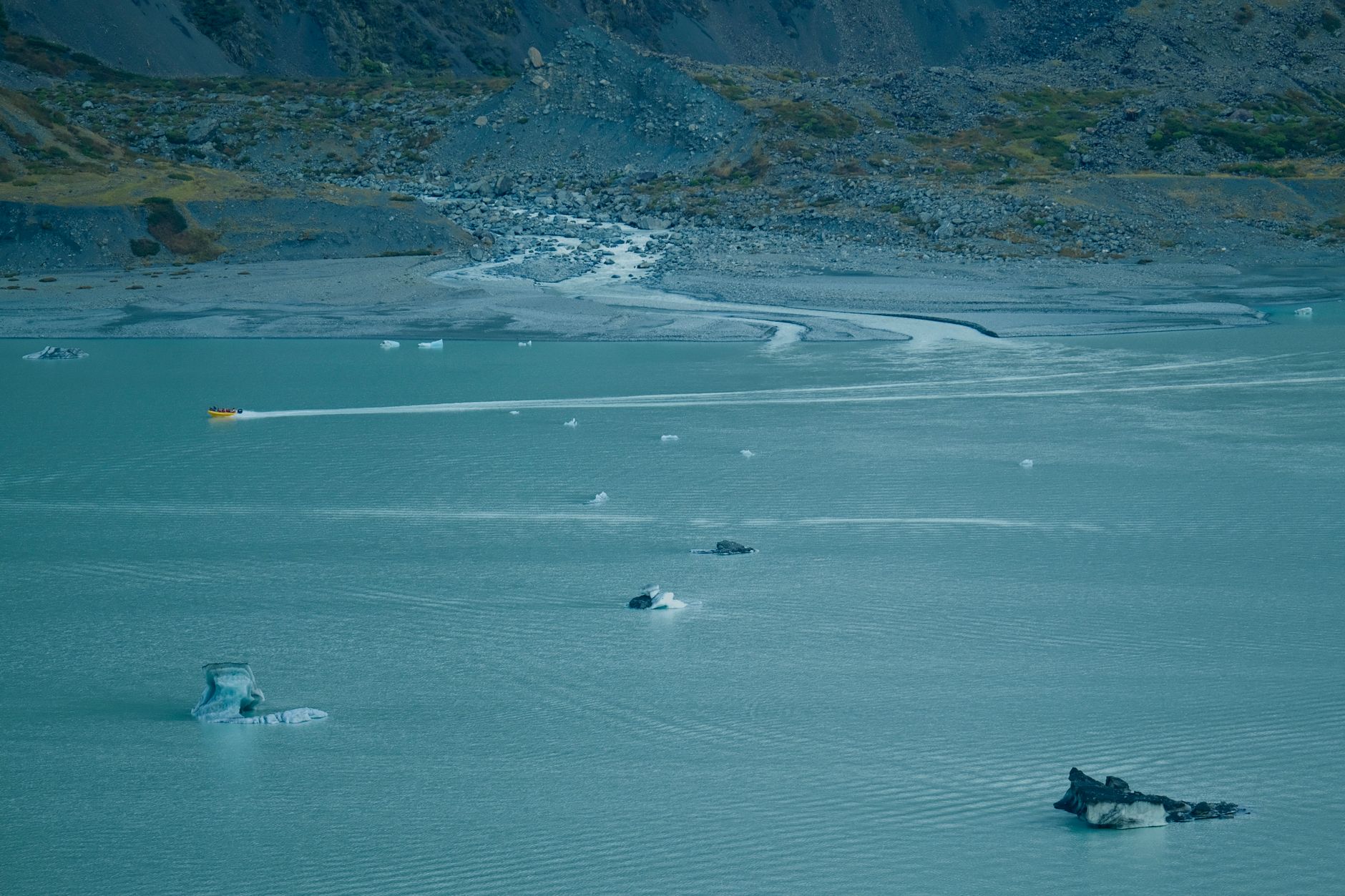
A glacier boat tour on the Tasman terminal lake
Take a guided boat tour among the icebergs on the Tasman Glacier's terminal lake beneath Aoraki/Mount Cook.
Day 4: Over the Mackenzie to Queenstown
Lake Tekapo → Lake Pukaki → Queenstown — a free turquoise-lake lookout and a lakeside arrival
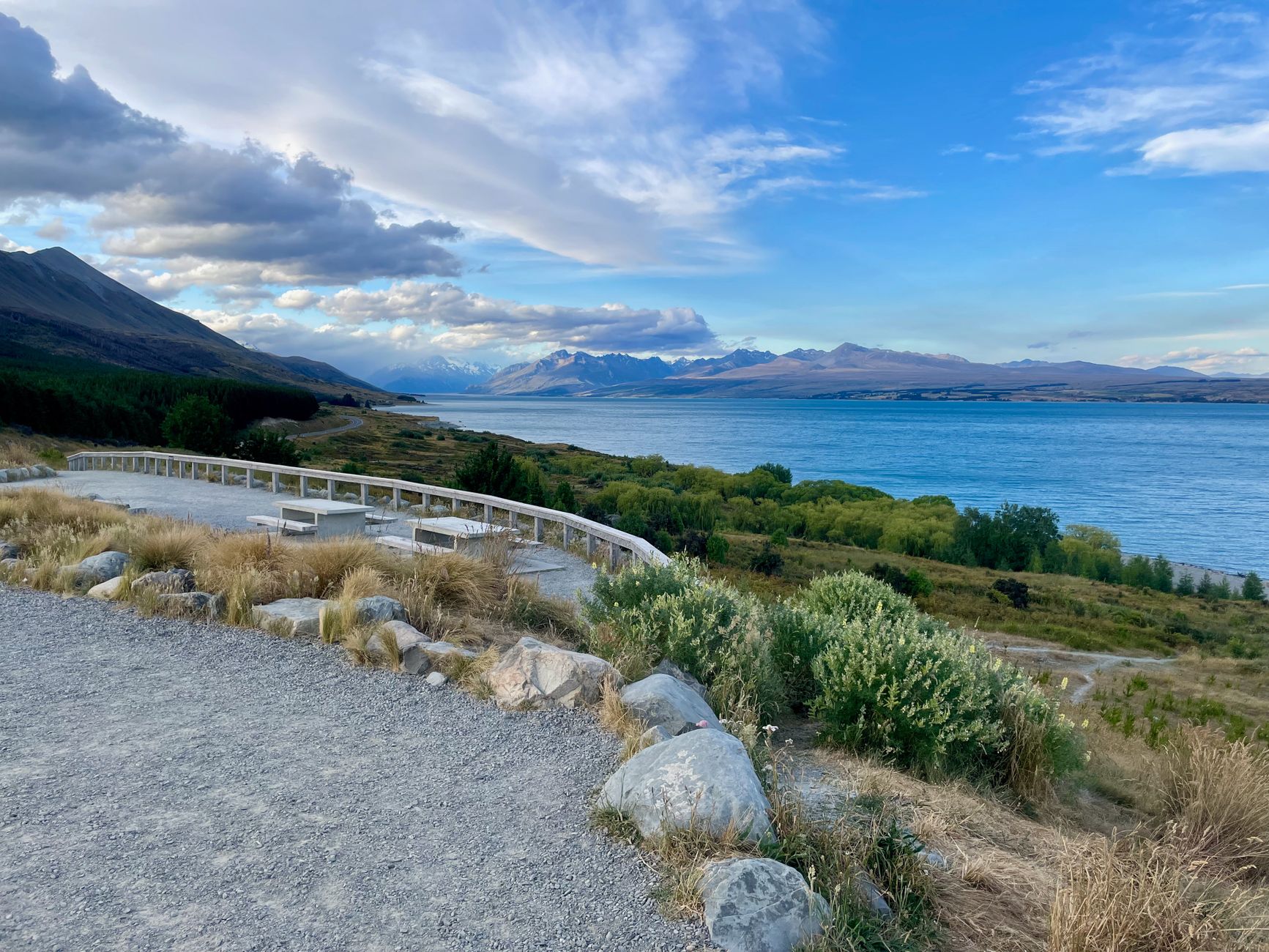
Lake Pukaki lookout
Stop at a free roadside viewpoint over the milky-turquoise glacial lake, with Aoraki/Mount Cook on the horizon on a clear day.
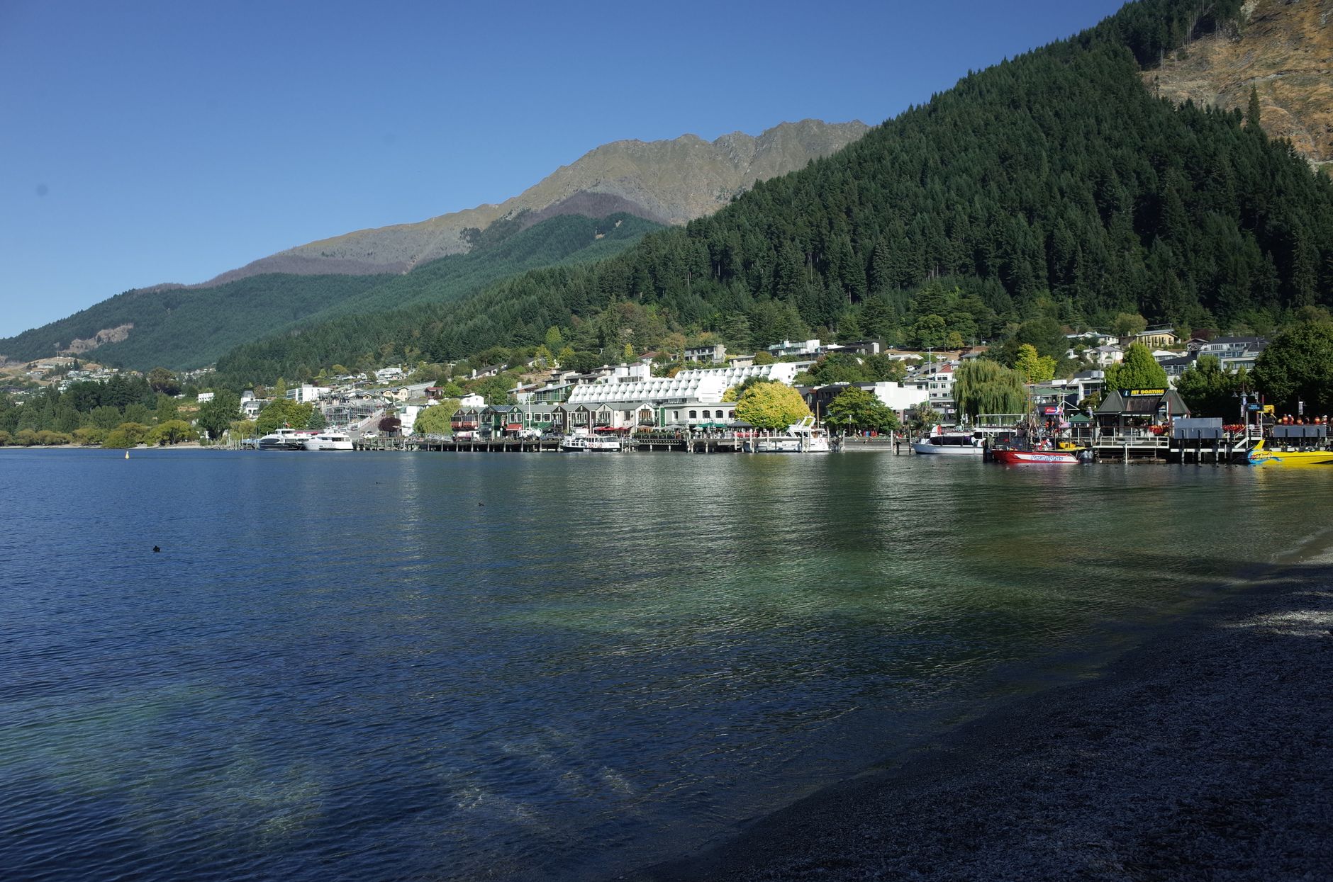
Arrive in Queenstown on Lake Wakatipu
Arrive in New Zealand's adventure capital on the shore of Lake Wakatipu and settle in for two nights.
Day 5: Queenstown — the gondola & the adrenaline
Base: Queenstown — a high lake view, a jet-boat ride and the original commercial bungy site

The Skyline Gondola above Queenstown
Ride the ticketed cable car up Bob's Peak to a viewing deck high over Lake Wakatipu; luge, dining and paragliding launch from the top.
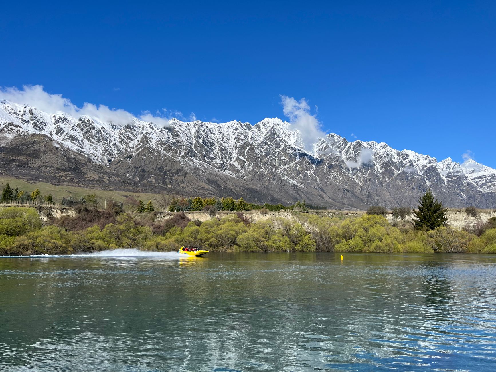
A Queenstown jet-boat ride
Take a ticketed high-speed jet-boat ride through the canyons and shallows of the Shotover or Kawarau rivers below the Remarkables.

The Kawarau Bridge bungy
Book a ticketed jump from the historic Kawarau Bridge, the world's original commercial bungy site, or watch from the platform for free.
Day 6: A day trip to Milford Sound
Queenstown → Te Anau → Milford Sound → Queenstown — a long alpine-road day and a fiord cruise
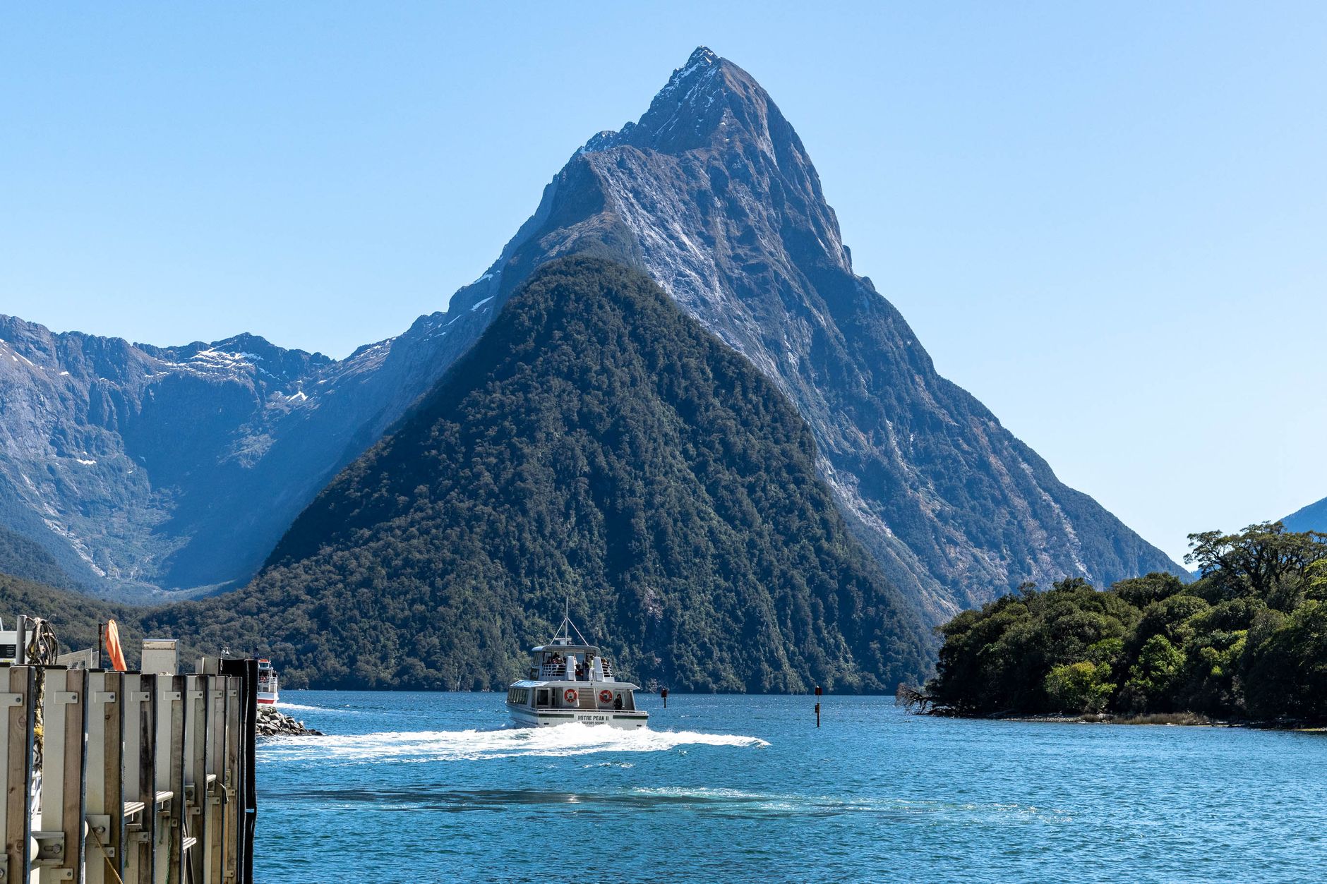
The drive (or coach) into Fiordland
Milford is a long day from Queenstown, several hours each way via Te Anau and the Homer Tunnel. Take a guided coach so someone else drives the winding alpine road, or self-drive very early, and check road and avalanche status before setting out.
A scenic cruise on Milford Sound
Take a guided nature cruise along the fiord beneath Mitre Peak and past waterfalls toward the Tasman Sea.
Day 7: Over the Crown Range & Haast Pass to the glaciers
Queenstown → Crown Range → Haast Pass → Franz Josef — a long five-to-six-hour drive, so leave Queenstown early to reach the West Coast glacier valley with time for a guided ice trip

Drive Queenstown to Franz Josef over the passes
This is a long day of about five to six hours over the Crown Range and Haast Pass, so leave Queenstown early and check road and weather status before setting out. If you arrive late, keep the guided ice trip for the next morning before the drive to Wanaka.

Franz Josef Glacier valley walk
On arrival, walk the free public track through the glacier valley to the lookout, from where the ice sits some distance up the valley — the river washout means the track no longer reaches the terminal face. It is a good, low-commitment stretch after the long drive; the ice itself is only safely reached on a guided trip.
A guided glacier walk or heli-hike on Franz Josef
Reach the ice only on a guided glacier walk or helicopter heli-hike with a licensed operator, who supplies crampons and leads the route through the seracs and blue ice. Slots are fixed and weather-dependent, and heli-hikes are the first to be grounded, so book ahead and treat the next morning as a fallback if the drive or the weather runs late.
Day 8: Inland to Wanaka — the lakeshore
Franz Josef → Wanaka — a three-and-a-half to four-and-a-half-hour drive over Haast Pass, arriving with time for a free lakeshore photo stop; save the Roys Peak hike for an early start tomorrow

Drive Franz Josef to Wanaka over Haast Pass
Drive three and a half to four and a half hours south over the Haast Pass, following the West Coast and the chain of glacial lakes into Wanaka. Check road and weather status, watch the fuel gauge, and plan to arrive with the afternoon free rather than trying to squeeze in the long Roys Peak hike on the same day.
That Wanaka Tree on the lakeshore
On arrival, see the lone willow standing in the shallows of Lake Wanaka, a free lakeshore photo stop in Wanaka town rather than a ticketed site — an easy stretch after the drive before an early night ahead of the Roys Peak climb.
Day 9: Roys Peak at dawn, then back across the island
Wanaka → Christchurch — an early Roys Peak climb, then the long drive is broken with a night in Christchurch instead of pushing all the way to the coast
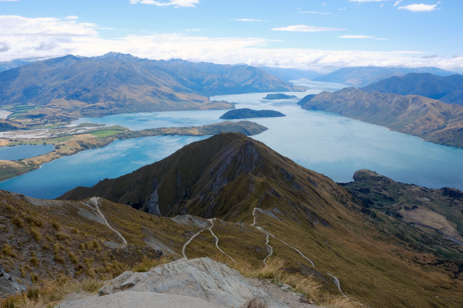
The Roys Peak Track above Lake Wanaka
Start at first light on the free but steep sixteen-kilometre return track, a five-to-six-hour climb to the famous ridgeline lookout over Lake Wanaka. Carry water and sun protection, turn back in bad weather, and be back down by early afternoon.
Drive to Christchurch to break the return leg
After the hike, drive about five and a half hours back across the island to Christchurch rather than pushing the full seven-to-eight-hour haul to Kaikoura in one go. Watch the fuel gauge on remote stretches, and settle in Christchurch for the night so the whale watch tomorrow is fresh rather than rushed.
Day 10: The coast to Kaikoura & the whales
Christchurch → Kaikoura — a short coastal drive, then a weather-dependent whale-watching trip on the final day
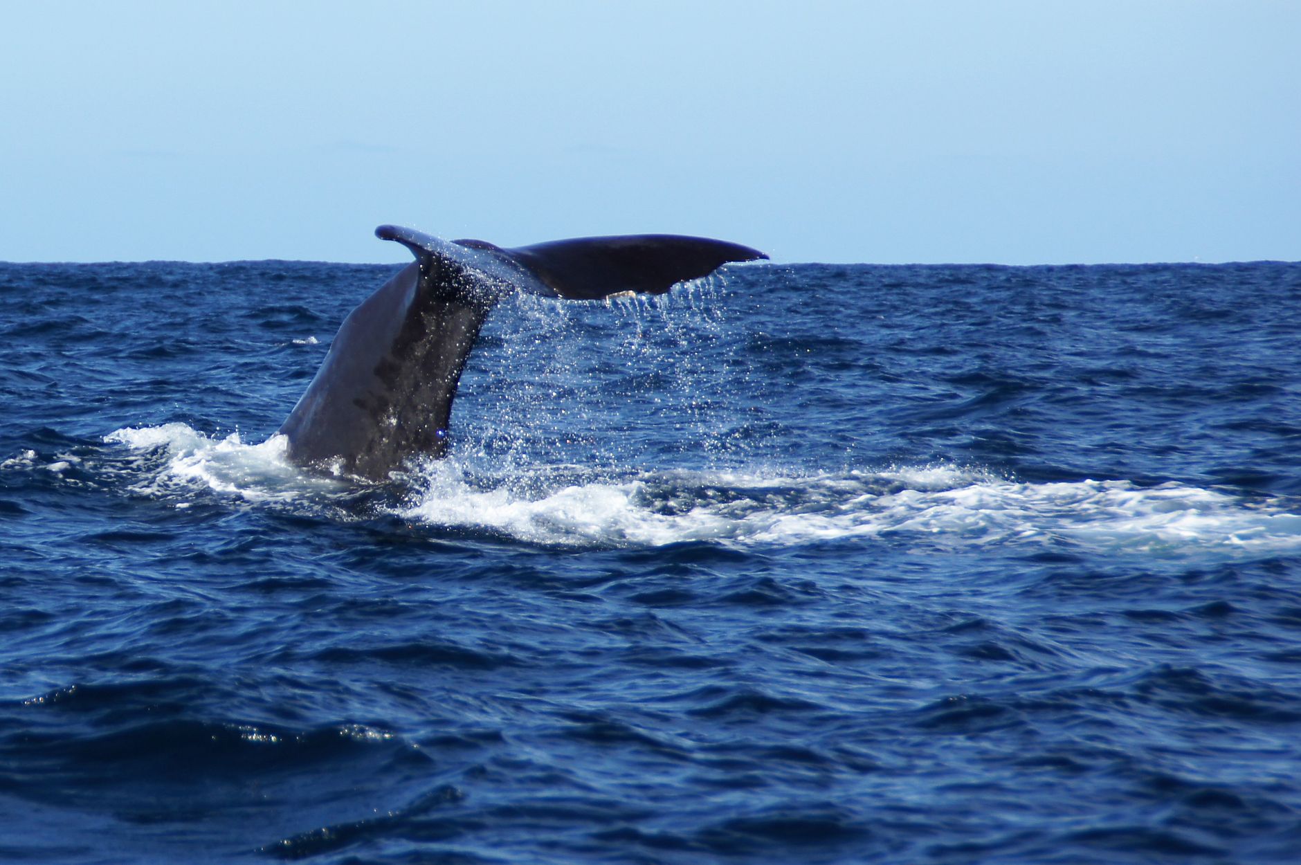
Drive the coast from Christchurch to Kaikoura
Set off early for the short two-and-a-half-hour coastal drive north up State Highway 1 to Kaikoura, checking road status because this stretch is prone to weather closures. Arriving mid-morning leaves time for an early-afternoon whale-watch departure.
Whale watching off Kaikoura
Join a bookable boat trip over the deep Kaikoura Canyon, where resident sperm whales, dusky dolphins and seabirds gather. Sightings are weather-dependent and operators reschedule for rough seas, so aim for a morning or early-afternoon departure and keep a buffer before any onward travel. From Kaikoura it is about two and a half hours back to Christchurch (CHC) for a later flight or an onward night.
Christchurch through the Mackenzie Country, Fiordland and the West Coast
Nine master-image anchors trace the clockwise road trip from Christchurch through Tekapo and Aoraki/Mount Cook to Queenstown, Milford Sound, Franz Josef, Wanaka and Kaikoura.
- 1
Christchurch Botanic Gardens
Christchurch arrival and an easy first-day walk
- 2
Church of the Good Shepherd
Lake Tekapo and the Mackenzie night sky
- 3
Hooker Valley Track
Aoraki/Mount Cook National Park
- 4
Queenstown on Lake Wakatipu
Arrival in the South Island's adventure capital
- 5
Skyline Gondola
Queenstown from Bob's Peak
- 6
Milford Sound
Fiordland cruise beneath Mitre Peak
- 7
Franz Josef Glacier
A guided walk or heli-hike on the glacier
- 8
Roys Peak
A ridgeline above Lake Wanaka
- 9
Kaikoura
Whale watching off the east coast
Frequently Asked Questions
How long do you need for a South Island road trip?
About ten days lets you loop Christchurch–Tekapo–Mount Cook–Queenstown–Milford–the glaciers–Wanaka–Kaikoura without rushing; two weeks is more relaxed.
When is the best time to drive the South Island?
December to March has the longest, most settled days for driving and hiking; winter brings snow to the passes and shorter daylight.
Do I need a car, or can I do this by tour?
A rental car or campervan is the natural way to drive the loop. Milford Sound in particular can also be done as a guided coach day from Queenstown if you would rather not drive the alpine road.
Is driving in New Zealand difficult for visitors?
Roads are mostly two-lane with one-lane bridges and winding alpine passes. Drive on the left, allow far more time than the distance suggests, and never rush.
Do I need to book Milford Sound cruises and glacier walks in advance?
Yes. In the December to March peak these and Kaikoura whale watching fill up and are weather-dependent, so book ahead and keep a spare day.
Can you walk on the Franz Josef Glacier itself?
Only on a guided glacier walk or helicopter heli-hike with a licensed operator. The valley walk to the terminal viewpoint is a free public track, but the ice is not safe to reach unguided.
Is the Hooker Valley Track suitable for most people?
It is a mostly flat, well-formed public track with swing bridges and no entry fee, but it is exposed to mountain weather, so carry layers and water and check conditions.
Will I definitely see whales at Kaikoura?
Resident sperm whales are seen year-round and operators have high success rates, but sightings are never guaranteed and trips are rescheduled in rough seas.
What should I watch out for on the drive?
Watch for long distances between towns, sparse fuel in the high country and on the West Coast, one-lane bridges, and fast-changing mountain weather. Fill up when you can and check road status before the Milford and Haast roads.
Make this plan your own
Copy this plan into your account in one click — keep the original for reference and edit your copy any way you like.
Sign in once to save and edit your own copy.